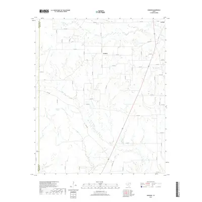
2019 Map of Hodgson
USGS Topo · Published 2019About this map
Hodgson serves as a central landmark in this Bowie County landscape, where the terrain is defined by a dense network of creek drainages and local farm roads. The boundary between Red River Co and Bowie Co runs along the western edge, near the Cedar Creek Cem and the waters of Cedar Cr. A complex hydrology of small streams, including Anderson Cr to the north and the south-flowing Dalby Cr, shapes the rural character of the area. The presence of De Kalb Lake and the open expanse of Caughorn Prairie provide distinct geographic markers amidst the winding tributaries like Boothe Cr and Dogwood Br. This 2019 survey documents a modern rural Texas environment where historical land divisions and original watercourse names persist despite the overlay of contemporary county road systems.
Find a feature on this map
62 named features on this map. Tap any name to fly to it.
Don’t see what you’re looking for? This feature index may not catch every label — zoom into the map to look around manually.
Map Details
Editions of this 2019 Hodgson Map
This is the sole edition of this map. No revisions or reprints were ever made.
Other maps of this area

1930 · Bassett
USGS Topo · 1:62,500

1950 · De Kalb
USGS Topo · 1:24,000

1950 · Oak Grove
USGS Topo · 1:24,000

1951 · De Kalb
USGS Topo · 1:24,000

1951 · Oak Grove
USGS Topo · 1:24,000

1951 · Avery
USGS Topo · 1:24,000

1953 · Texarkana
USGS Topo · 1:250,000

1956 · Texarkana
USGS Topo · 1:250,000

1965 · Lydia
USGS Topo · 1:24,000
1965 · Hodgson
USGS Topo · 1:24,000