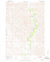
1953 Map of Hoe Ranch
USGS Topo · Published 1970About this map
The Powder River carves a winding path through this portion of Johnson County, creating a distinct riparian corridor amidst the high plains topography. This 1953 field check captures the ranching footprint of the era, centered on the Irigaray Ranch and the identified Hoe Ranch (Historical Site). The inclusion of the United States Atomic Energy Commission in the margin reflects the Cold War era's interest in uranium exploration across the basin. Away from the river, the landscape is defined by a series of drainages including Curtis Draw, Ninemile Creek, and Willow Creek. Local landmarks like Falxa Camp and a rural School along Section Draw indicate the sparse but established community infrastructure. Numerous artesian wells and a Footbridge over the river highlight the practical water management and transit necessary for sheep and cattle operations in this environment.
Find a feature on this map
22 named features on this map. Tap any name to fly to it.
Don’t see what you’re looking for? This feature index may not catch every label — zoom into the map to look around manually.
Map Details
Editions of this 1953 Hoe Ranch Map
3 editions found
Other maps of this area

1953 · Hoe Ranch
USGS Topo · 1:24,000

1953 · Fort Reno
USGS Topo · 1:24,000

1953 · Fort Reno SE
USGS Topo · 1:24,000

1953 · The Nipple
USGS Topo · 1:24,000

1955 · Sheridan
USGS Topo · 1:250,000

1955 · Arminto
USGS Topo · 1:250,000

1958 · Sheridan
USGS Topo · 1:250,000

1958 · Arminto
USGS Topo · 1:250,000

1961 · Soldier Creek
USGS Topo · 1:24,000

1961 · Provence Ranch
USGS Topo · 1:24,000