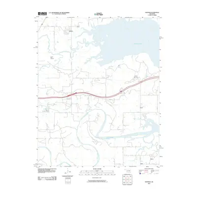
2010 Map of Hoffman
USGS Topo · Published 2010About this map
Hoffman and the winding reaches of the North Canadian River anchor this 2010 topographic study of Okmulgee County. The landscape is defined by the significant footprint of Eufaula Lake to the northeast, where the waters of the Deep Fork and Cat Creek converge. A clear pattern of rural development is visible, with small communities like Burney and Lenna situated along a grid of county roads that navigate the varying elevations around Tiger Mountain. For those researching local heritage, the map identifies several key burial sites, including Hoffman Cemetery, Thompson Cemetery, and Morrison Cemetery. The inclusion of landmarks such as the Sallisaw Park Lake Dam and Cowden Lake Dam highlights the importance of water management in this part of Oklahoma, where creeks like Wolf Creek and Limbo Creek thread through the hills and plains.
Find a feature on this map
37 named features on this map. Tap any name to fly to it.
Don’t see what you’re looking for? This feature index may not catch every label — zoom into the map to look around manually.
Map Details
Editions of this 2010 Hoffman Map
This is the sole edition of this map. No revisions or reprints were ever made.
Other maps of this area

1896 · Okmulgee
USGS Topo · 1:125,000

1900 · Canadian
USGS Topo · 1:125,000

1900 · Okmulgee
USGS Topo · 1:125,000

1946 · Fort Smith
USGS Topo · 1:250,000

1962 · Henryetta
USGS Topo · 1:24,000

1962 · Raiford
USGS Topo · 1:24,000

1962 · Henryetta SW
USGS Topo · 1:24,000

1962 · Pierce
USGS Topo · 1:24,000

1962 · Hoffman
USGS Topo · 1:24,000

1963 · Stidham
USGS Topo · 1:24,000