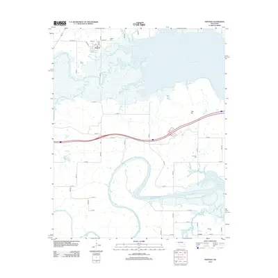
2012 Map of Hoffman
USGS Topo · Published 2012About this map
Hoffman and the small settlement of Lenna anchor this landscape, where the meandering course of the N Canadian River meets the western reaches of Eufaula Lake. The map reveals a complex hydrology dominated by the broad wetlands of the Deep Fork and numerous tributaries such as Limbo Cr and Wolf Cr. The river's path is marked by dramatic oxbow bends and wide bottomlands, contrasting with the rising elevation of Tiger Mtn to the east. Local history and genealogy are preserved in the locations of Hoffman Cem, Thompson Cem, and Morrison Cem. These sites, along with the grid of section roads like E 1090 RD, illustrate the intersection of pioneer-era burial grounds with the modern transportation network and the large-scale impoundment of the lake.
Find a feature on this map
45 named features on this map. Tap any name to fly to it.
Don’t see what you’re looking for? This feature index may not catch every label — zoom into the map to look around manually.
Map Details
Editions of this 2012 Hoffman Map
This is the sole edition of this map. No revisions or reprints were ever made.
Other maps of this area

1896 · Okmulgee
USGS Topo · 1:125,000

1900 · Canadian
USGS Topo · 1:125,000

1900 · Okmulgee
USGS Topo · 1:125,000

1946 · Fort Smith
USGS Topo · 1:250,000

1962 · Henryetta
USGS Topo · 1:24,000

1962 · Raiford
USGS Topo · 1:24,000

1962 · Henryetta SW
USGS Topo · 1:24,000

1962 · Pierce
USGS Topo · 1:24,000

1962 · Hoffman
USGS Topo · 1:24,000

1963 · Stidham
USGS Topo · 1:24,000