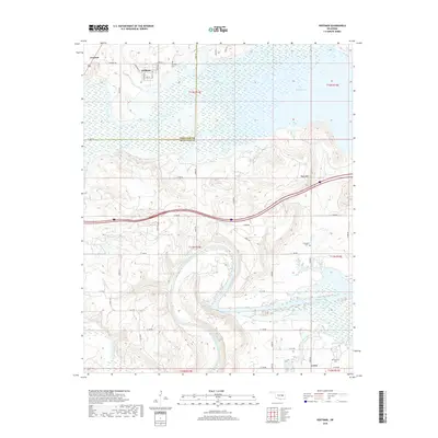
2018 Map of Hoffman
USGS Topo · Published 2018About this map
Hoffman and the nearby community of Grayson occupy the northern plains of this Okmulgee County landscape, situated just west of the expansive waters of Eufaula Lake. The terrain transitions from the low-lying wetlands of the North Canadian River valley to the prominent elevation of Tiger Mtn in the east. This 2018 survey reveals a rural infrastructure defined by a grid of section-line roads, such as Hoffman Rd and Lenna Rd, which connect the small settlements and family burial grounds that anchor the local history.
Find a feature on this map
48 named features on this map. Tap any name to fly to it.
Don’t see what you’re looking for? This feature index may not catch every label — zoom into the map to look around manually.
Map Details
Editions of this 2018 Hoffman Map
This is the sole edition of this map. No revisions or reprints were ever made.
Other maps of this area

1896 · Okmulgee
USGS Topo · 1:125,000

1900 · Canadian
USGS Topo · 1:125,000

1900 · Okmulgee
USGS Topo · 1:125,000

1946 · Fort Smith
USGS Topo · 1:250,000

1962 · Henryetta
USGS Topo · 1:24,000

1962 · Raiford
USGS Topo · 1:24,000

1962 · Henryetta SW
USGS Topo · 1:24,000

1962 · Pierce
USGS Topo · 1:24,000

1962 · Hoffman
USGS Topo · 1:24,000

1963 · Stidham
USGS Topo · 1:24,000