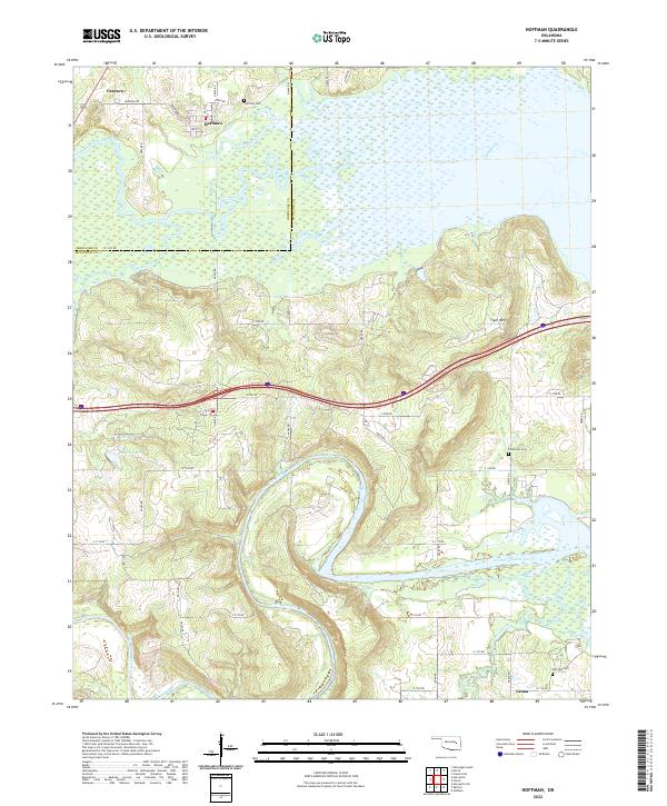
2022 Map of Hoffman
USGS Topo · Published 2022About this map
The lowlands and river valleys of eastern Oklahoma define this landscape where Okmulgee and McIntosh counties meet. The settlement of Hoffman sits at the northern edge, characterized by its grid of local streets including Broadway St and Main St, while the community of Grayson lies just to the west. This area is heavily influenced by the presence of Eufaula Lake and the meandering course of the North Canadian River, which winds through the southern portion of the quadrangle. Significant elevation changes are marked by Tiger Mtn, rising above the surrounding wetlands and drainage systems like Wolf Creek and Limbo Creek. Genealogy researchers will find several local burial sites recorded, including Hoffman Cem near the townsite and both Thompson Cem and Morrison Cem further south near Lenna. Smaller bodies of water such as Cowden Lake and Clear Cr dot the interior terrain between the major river systems.
Find a feature on this map
35 named features on this map. Tap any name to fly to it.
Don’t see what you’re looking for? This feature index may not catch every label — zoom into the map to look around manually.
Map Details
Editions of this 2022 Hoffman Map
This is the sole edition of this map. No revisions or reprints were ever made.
Other maps of this area

1896 · Okmulgee
USGS Topo · 1:125,000

1900 · Canadian
USGS Topo · 1:125,000

1900 · Okmulgee
USGS Topo · 1:125,000

1946 · Fort Smith
USGS Topo · 1:250,000

1962 · Henryetta
USGS Topo · 1:24,000

1962 · Raiford
USGS Topo · 1:24,000

1962 · Henryetta SW
USGS Topo · 1:24,000

1962 · Pierce
USGS Topo · 1:24,000

1962 · Hoffman
USGS Topo · 1:24,000

1963 · Stidham
USGS Topo · 1:24,000