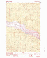
1983 Map of Hoffstadt Mtn
USGS Topo · Published 1984About this map
The North Fork Toutle River valley undergoes a profound transformation in this 1983 survey, which documents the scarred landscape following the 1980 eruption of Mount St. Helens. Extensive zones of Mud Flow and massive areas of Blowdown dominate the river corridor, illustrating the immense power of the volcanic event. To manage the shifting sediment, engineering works like the Toutle Dam and the Debris Dam Earth Fill appear as critical infrastructure projects.
Find a feature on this map
23 named features on this map. Tap any name to fly to it.
Don’t see what you’re looking for? This feature index may not catch every label — zoom into the map to look around manually.
Map Details
Editions of this 1983 Hoffstadt Mtn Map
This is the sole edition of this map. No revisions or reprints were ever made.
Other maps of this area

1919 · Mount St Helens
USGS Topo · 1:125,000

1942 · Toutle
USGS Topo · 1:62,500

1943 · Pigeon Springs
USGS Topo · 1:62,500

1953 · Hoquiam
USGS Topo · 1:250,000

1953 · Toutle
USGS Topo · 1:62,500

1953 · Pigeon Springs
USGS Topo · 1:62,500

1953 · Cougar
USGS Topo · 1:62,500

1953 · Elk Rock
USGS Topo · 1:62,500

1957 · Hoquiam
USGS Topo · 1:250,000

1958 · Hoquiam
USGS Topo · 1:250,000