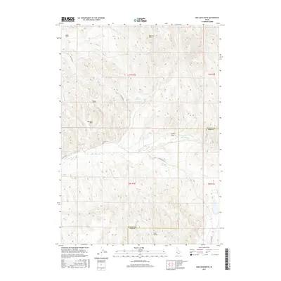
2017 Map of Hog Cove Butte
USGS Topo · Published 2017About this map
Hog Cove Butte dominates the northern skyline of this territory along the border of Payette and Gem counties. The landscape is defined by a network of drainage systems including Hog Cove Cr and N Fork Alkali Cr, which cut through the high ground of Bannister Basin and Sheep Gulch. Water management for the region's agricultural and ranching needs is evident at Bettis Reservoir and the isolated Rayner Spring. The southern portion of the map transitions into the lower elevations of Sand Hollow, where the terrain begins to level out. Established travel routes like Dry Creek Rd and Big Willow Rd follow the natural contours of the valley floors, providing vital connectivity between the scattered basins and gulches of this rural Idaho interior.
Find a feature on this map
25 named features on this map. Tap any name to fly to it.
Don’t see what you’re looking for? This feature index may not catch every label — zoom into the map to look around manually.
Map Details
Editions of this 2017 Hog Cove Butte Map
This is the sole edition of this map. No revisions or reprints were ever made.
Other maps of this area

1892 · Boise
USGS Topo · 1:125,000

1894 · Squaw Creek
USGS Topo · 1:125,000

1897 · Boise
USGS Topo · 1:125,000

1897 · Weiser
USGS Topo · 1:125,000

1898 · Nampa
USGS Topo · 1:125,000

1953 · Montour
USGS Topo · 1:62,500

1955 · Baker
USGS Topo · 1:250,000

1955 · Boise
USGS Topo · 1:250,000

1958 · Boise
USGS Topo · 1:250,000

1959 · Baker
USGS Topo · 1:250,000