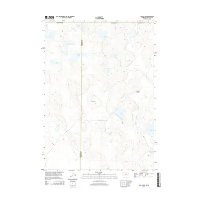
2014 Map of Hog Island
USGS Topo · Published 2014About this map
Hog Island rises as a prominent landmark amidst the intricate wetland and dune topography of the Nebraska Sandhills along the South Dakota border. This 2014 survey documents a landscape dominated by a network of seasonal and permanent water bodies, reflecting the unique hydrology of the Sheridan Co and Cherry Co borderlands. The map traces the varied contours of the terrain, where named features like Horseshoe Meadow and Shell Lake indicate the historical importance of these water sources in an otherwise arid region.
Find a feature on this map
24 named features on this map. Tap any name to fly to it.
Don’t see what you’re looking for? This feature index may not catch every label — zoom into the map to look around manually.
Map Details
Editions of this 2014 Hog Island Map
This is the sole edition of this map. No revisions or reprints were ever made.
Other maps of this area

1950 · Irwin
USGS Topo · 1:62,500

1951 · Irwin
USGS Topo · 1:62,500

1955 · Hot Springs
USGS Topo · 1:250,000

1955 · Alliance
USGS Topo · 1:250,000

1955 · Martin
USGS Topo · 1:250,000

1957 · Alliance
USGS Topo · 1:250,000

1957 · Valentine
USGS Topo · 1:250,000

1958 · Martin
USGS Topo · 1:250,000

1958 · Alliance
USGS Topo · 1:250,000

1959 · Valentine
USGS Topo · 1:250,000