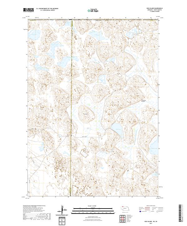
2021 Map of Hog Island
USGS Topo · Published 2021About this map
Hog Island rises above a labyrinth of seasonal wetlands and prairie lakes in this 2021 snapshot of the Nebraska Sandhills. Located along the border of Sheridan and Cherry counties, the landscape is defined by its complex hydrology, where numerous named water bodies like Shell Lake, Dads Lake, and Esther Lake punctuate the grass-stabilized dunes. The presence of Horseshoe Drainage Ditch suggests historical efforts to manage water levels in this naturally low-lying basin, while features like Horseshoe Meadow indicate areas of grazing land interspersed among the marshes.
Find a feature on this map
26 named features on this map. Tap any name to fly to it.
Don’t see what you’re looking for? This feature index may not catch every label — zoom into the map to look around manually.
Map Details
Editions of this 2021 Hog Island Map
This is the sole edition of this map. No revisions or reprints were ever made.
Other maps of this area

1950 · Irwin
USGS Topo · 1:62,500

1951 · Irwin
USGS Topo · 1:62,500

1955 · Hot Springs
USGS Topo · 1:250,000

1955 · Alliance
USGS Topo · 1:250,000

1955 · Martin
USGS Topo · 1:250,000

1957 · Alliance
USGS Topo · 1:250,000

1957 · Valentine
USGS Topo · 1:250,000

1958 · Martin
USGS Topo · 1:250,000

1958 · Alliance
USGS Topo · 1:250,000

1959 · Valentine
USGS Topo · 1:250,000