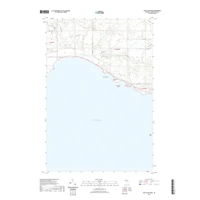
2019 Map of Hog Island Point
USGS Topo · Published 2019About this map
Lake Michigan dominates the southern landscape of this 2019 survey, where the Upper Peninsula coastline is defined by distinctive landforms and shallow offshore features. Along the shoreline, Gravel Island and the hook of Hog Island Point create a sheltered stretch of water, while Little Hog Island sits just off the coast. Farther south in the open water, the submerged Pelkie Reef stands as a significant navigational landmark for the region.
Find a feature on this map
28 named features on this map. Tap any name to fly to it.
Don’t see what you’re looking for? This feature index may not catch every label — zoom into the map to look around manually.
Map Details
Editions of this 2019 Hog Island Point Map
This is the sole edition of this map. No revisions or reprints were ever made.
Other maps of this area

1931 · Epoufette NW
USGS Topo · 1:31,680

1931 · Epoufette SW
USGS Topo · 1:31,680

1931 · Gilchrist NE
USGS Topo · 1:31,680

1931 · Gilchrist NW
USGS Topo · 1:31,680

1954 · Sault Sainte Marie
USGS Topo · 1:250,000

1955 · Hog Island
USGS Topo · 1:62,500

1955 · Cheboygan
USGS Topo · 1:250,000

1956 · Sault Sainte Marie
USGS Topo · 1:250,000

1957 · Sault Sainte Marie
USGS Topo · 1:250,000

1958 · Cheboygan
USGS Topo · 1:250,000