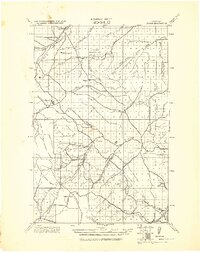
1943 Map of Hogan
USGS Topo · Published 1943About this map
Augusta anchors the northern portion of this landscape, situated near the transition from the plains to the mountains where the Sun River and its southern fork emerge from the high country. The terrain is defined by the Continental Divide and Rogers Pass, creating a dramatic backdrop for early settlements like Hogan, Stearns, and Fulton. This military survey, compiled under Col. Chas. L. Potter, reveals a network of drainage systems such as the Dearborn River and Simms Creek that dictated the placement of early ranching and mining outposts.
Find a feature on this map
49 named features on this map. Tap any name to fly to it.
Don’t see what you’re looking for? This feature index may not catch every label — zoom into the map to look around manually.
Map Details
Editions of this 1943 Hogan Map
This is the sole edition of this map. No revisions or reprints were ever made.
Other maps of this area

1886 · Great Falls
USGS Topo · 1:250,000

1886 · Fort Logan
USGS Topo · 1:250,000

1889 · Helena
USGS Topo · 1:250,000

1893 · Helena
USGS Topo · 1:250,000

1899 · Helena
USGS Topo · 1:250,000
1903 · Saypo
USGS Topo · 1:125,000
1903 · Coopers Lake
USGS Topo · 1:125,000

1903 · Helena
USGS Topo · 1:250,000
1920 · Choteau
USGS Topo · 1:125,000

1947 · Butte
USGS Topo · 1:250,000