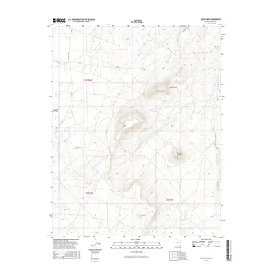
2017 Map of Hogan Mesa
USGS Topo · Published 2017About this map
Hogan Mesa dominates this landscape in San Juan County, Utah, providing a high-elevation anchor for a region defined by arid drainages and seasonal water sources. The map documents a sparsely settled area where life is tied closely to the land and the limited availability of water, as seen at Little Water Spring and Salt Water Spring. A small settlement at Casa del Eco Mesa and the prominent landmark of Standing Rock serve as key points of reference within the vast desert terrain.
Find a feature on this map
23 named features on this map. Tap any name to fly to it.
Don’t see what you’re looking for? This feature index may not catch every label — zoom into the map to look around manually.
Map Details
Editions of this 2017 Hogan Mesa Map
This is the sole edition of this map. No revisions or reprints were ever made.
Other maps of this area

1886 · Abajo
USGS Topo · 1:250,000

1892 · Abajo
USGS Topo · 1:250,000

1893 · Abajo
USGS Topo · 1:250,000

1956 · Cortez
USGS Topo · 1:250,000

1958 · Cortez
USGS Topo · 1:250,000

1959 · Cortez
USGS Topo · 1:250,000

1962 · Cortez
USGS Topo · 1:250,000

1962 · Montezuma Creek
USGS Topo · 1:62,500

1962 · Bluff
USGS Topo · 1:62,500
1962 · Boundary Butte
USGS Topo · 1:62,500