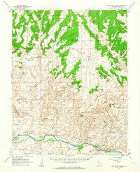
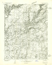
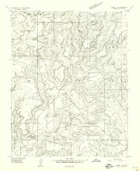
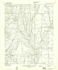
1962 Map of Montezuma Creek
USGS Topo · Published 1963About this map
The Aneth Oil Field dominates the southeastern corner of this 1960s landscape, reflecting an era of industrial expansion along the northern banks of the San Juan River. This territory is defined by the meeting of the Ute Indian Reservation and the Navajo Indian Reservation, with the San Juan River and several distinct mesas such as White Mesa and McCracken Mesa carving through the high desert. The map reveals a specialized infrastructure supporting the petroleum industry, including the Aneth Airstrip, a Natural Gas Plant, and a Pumping Sta. Away from the river, the terrain rises into the broad expanses of Big Bench and Cowboy Pasture, while the settlement at Fiddlers Green and the Montezuma Creek Sch provide evidence of the area's local community and social services during this period of development.
Find a feature on this map
36 named features on this map. Tap any name to fly to it.
Don’t see what you’re looking for? This feature index may not catch every label — zoom into the map to look around manually.
Map Details
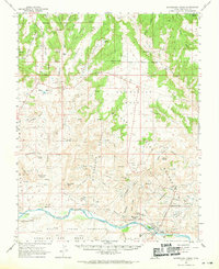
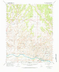
Editions of this 1962 Montezuma Creek Map
3 editions found
Other maps of this area

1886 · Abajo
USGS Topo · 1:250,000

1892 · Abajo
USGS Topo · 1:250,000

1893 · Abajo
USGS Topo · 1:250,000

1935 · Elk Ridge
USGS Topo · 1:96,000

1940 · Elk Ridge
USGS Topo · 1:125,000
1955 · Verdure 3 SE
USGS Topo · 1:24,000
1955 · Verdure 4 SW
USGS Topo · 1:24,000

1956 · Cortez
USGS Topo · 1:250,000
1957 · Aneth 1 NW
USGS Topo · 1:24,000
1957 · Elk Ridge 4 SE
USGS Topo · 1:24,000