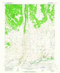
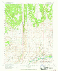
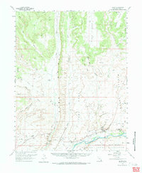
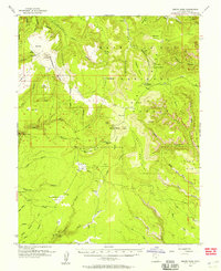
1962 Map of Bluff
USGS Topo · Published 1963About this map
Bluff sits at the base of Tank Bench along the north bank of the San Juan River, serving as a focal point for this 1962 survey of San Juan County. The map documents a cultural landscape defined by ancestral and modern habitation, featuring numerous Cliff Dwellings and ruins preserved within the sandstone alcoves of Comb Ridge and Black Mesa. The presence of the Mormon Road and the St Christophers Mission highlights the region's pioneer and missionary history, while the Navajo Indian Reservation occupies the southern reach of the quadrangle across the river. Topographic details reveal a complex system of washes like Butler Wash and Cottonwood Wash that have carved the high mesas, creating distinct landmarks such as the Navajo Twins and The Horn. This era shows early industrial exploration through scattered drill holes and the existence of a remote Airstrip near the river.
Find a feature on this map
52 named features on this map. Tap any name to fly to it.
Don’t see what you’re looking for? This feature index may not catch every label — zoom into the map to look around manually.
Map Details
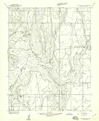
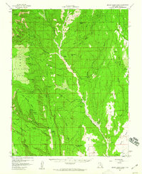
Editions of this 1962 Bluff Map
3 editions found
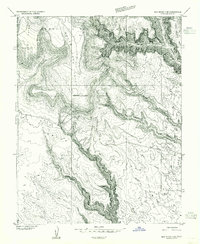
Other maps of this area

1886 · Abajo
USGS Topo · 1:250,000

1892 · Abajo
USGS Topo · 1:250,000

1893 · Abajo
USGS Topo · 1:250,000

1935 · Elk Ridge
USGS Topo · 1:96,000

1940 · Elk Ridge
USGS Topo · 1:125,000
1954 · Elk Ridge 3 SE
USGS Topo · 1:24,000
1954 · Bears Ears
USGS Topo · 1:62,500

1956 · Cortez
USGS Topo · 1:250,000
1957 · Elk Ridge 4 SE
USGS Topo · 1:24,000
1957 · Brushy Basin Wash
USGS Topo · 1:62,500