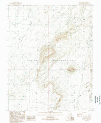
1989 Map of Hogan Mesa
USGS Topo · Published 1989About this map
Navajo Indian Reservation lands dominate this late-century landscape, where industrial activity is etched into the high desert of San Juan County. The terrain is defined by the massive Casa Del Eco Mesa and the central prominence of Hogan Mesa, both surrounded by a network of resource extraction. A high density of Oil Wells, Drill Holes, and supporting Tanks suggests a period of significant petroleum exploration, particularly in the northern reaches and near Little Water Spring. Along the eastern edge, Desert Creek winds past distinctive Sand Dunes and the lone landmark of Standing Rock. This 1980s field check records a remote interior of the Four Corners region, capturing the juxtaposition of ancient geological features like Hogan with modern infrastructure like the prominent Pipeline and Trans Line.
Find a feature on this map
20 named features on this map. Tap any name to fly to it.
Don’t see what you’re looking for? This feature index may not catch every label — zoom into the map to look around manually.
Map Details
Editions of this 1989 Hogan Mesa Map
This is the sole edition of this map. No revisions or reprints were ever made.
Other maps of this area

1886 · Abajo
USGS Topo · 1:250,000

1892 · Abajo
USGS Topo · 1:250,000

1893 · Abajo
USGS Topo · 1:250,000

1956 · Cortez
USGS Topo · 1:250,000

1958 · Cortez
USGS Topo · 1:250,000

1959 · Cortez
USGS Topo · 1:250,000

1962 · Cortez
USGS Topo · 1:250,000

1962 · Montezuma Creek
USGS Topo · 1:62,500

1962 · Bluff
USGS Topo · 1:62,500
1962 · Boundary Butte
USGS Topo · 1:62,500