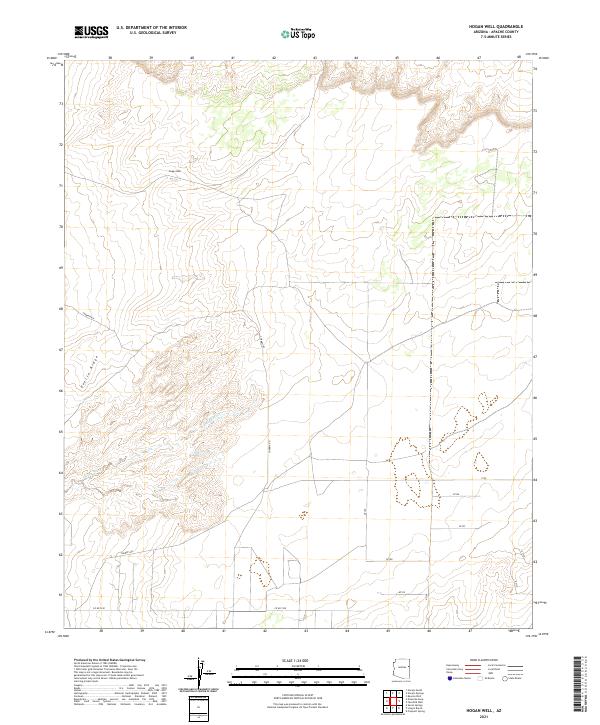
2021 Map of Hogan Well
USGS Topo · Published 2021About this map
Hogan Well is the central human landmark in this high-desert landscape, positioned amidst a vast network of section lines and range boundaries. The topography is defined by the prominent Puerco Ridge in the western half of the quadrangle, with drainage provided by the seasonal Milky Wash. This 2021 survey illustrates the rural infrastructure of Apache County, where transportation is reliant on a system of numbered routes and unpaved ways including Cherrys Rd and Co Rd 7230. The map provides a clear look at the Public Land Survey System for this region, showing the convergence of several townships and ranges, including t18n r27e and t18n r28e. The absence of large settlements highlights the remote, open character of this ranching or grazing territory.
Find a feature on this map
19 named features on this map. Tap any name to fly to it.
Don’t see what you’re looking for? This feature index may not catch every label — zoom into the map to look around manually.
Map Details
Editions of this 2021 Hogan Well Map
This is the sole edition of this map. No revisions or reprints were ever made.
Other maps of this area

1886 · St Johns
USGS Topo · 1:250,000

1886 · Fort Defiance
USGS Topo · 1:250,000

1892 · Fort Defiance
USGS Topo · 1:250,000

1892 · St Johns
USGS Topo · 1:250,000

1954 · Saint Johns
USGS Topo · 1:250,000

1954 · Gallup
USGS Topo · 1:250,000

1957 · Saint Johns
USGS Topo · 1:250,000

1958 · Gallup
USGS Topo · 1:250,000

1958 · Saint Johns
USGS Topo · 1:250,000

1959 · Gallup
USGS Topo · 1:250,000