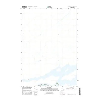
2016 Map of Hogansburg OE N
USGS Topo · Published 2016About this map
Lake St. Francis dominates the southern portion of this boundary region where the United States and Canada meet. This 2016 survey illustrates the international border along the upper St. Lawrence River, showing the line dividing New York and the United States from Canada. The topography is largely defined by the sprawling water of the lake and its complex shoreline, which transitions into the northern reaches of Franklin County. This map captures a specific modern perspective on the border’s path through these international waters, useful for tracing the precise jurisdictional boundaries of the river system before any subsequent shoreline or water level changes.
Find a feature on this map
3 named features on this map. Tap any name to fly to it.
Don’t see what you’re looking for? This feature index may not catch every label — zoom into the map to look around manually.
Map Details
Editions of this 2016 Hogansburg OE N Map
This is the sole edition of this map. No revisions or reprints were ever made.
Other maps of this area

1906 · Massena
USGS Topo · 1:62,500

1907 · Massena
USGS Topo · 1:62,500

1915 · Moira
USGS Topo · 1:62,500

1917 · Moira
USGS Topo · 1:62,500

1942 · Barnhart Island
USGS Topo · 1:24,000

1943 · Barnhart Island
USGS Topo · 1:31,680

1944 · Moira
USGS Topo · 1:62,500
1946 · Raquette River
USGS Topo · 1:24,000

1948 · Ogdensburg
USGS Topo · 1:250,000

1951 · Ogdensburg
USGS Topo · 1:250,000