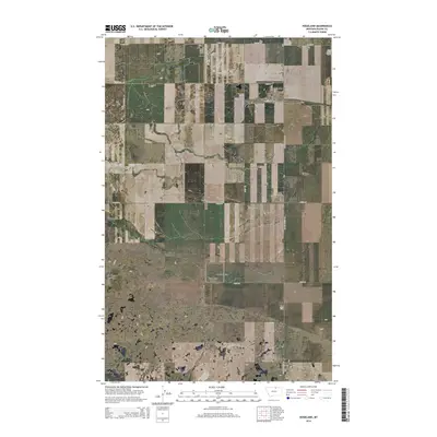
2014 Map of Hogeland
USGS Topo · Published 2014About this map
Hogeland is the primary focus of this northern Montana landscape, situated near the Canadian border in Blaine County. This agricultural and rural hub is defined by its small-town grid, featuring Main St and a local Post Office, which serve the surrounding ranching and farming operations. The terrain is marked by distinct geological drainages, most notably the winding paths of Murphy Coulee and East Butte Coulee, which cut through the high plains. Transportation in the area relies on a network of sectional roads and state routes, including Mt-338 and several named local thoroughfares like Twete Rd and Bison Rd. The Hogeland Airport north of the settlement reflects the region's historical reliance on general aviation for navigating the vast distances of the Big Sky country, while the Public Land Survey System grid lines divide the territory into townships like t36n r23e.
Find a feature on this map
23 named features on this map. Tap any name to fly to it.
Don’t see what you’re looking for? This feature index may not catch every label — zoom into the map to look around manually.
Map Details
Editions of this 2014 Hogeland Map
This is the sole edition of this map. No revisions or reprints were ever made.
Other maps of this area

1903 · Wayne Creek
USGS Topo · 1:62,500

1905 · Wayne Creek
USGS Topo · 1:62,500

1905 · Harlem
USGS Topo · 1:62,500

1913 · Cherry Ridge
USGS Topo · 1:125,000

1953 · Havre
USGS Topo · 1:250,000

1957 · Havre
USGS Topo · 1:250,000

1958 · Havre
USGS Topo · 1:250,000

1984 · Hogeland SE
USGS Topo · 1:24,000
1984 · Wayne Creek NW
USGS Topo · 1:24,000
1984 · Hogeland
USGS Topo · 1:24,000