
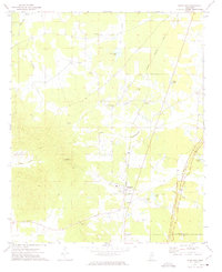
1972 Map of Hohenlinden
USGS Topo · Published 1974About this map
Montevista, Hohenlinden, and Clarkson anchor this rural landscape in Webster County during the early 1970s. The terrain is deeply carved by drainage systems like Buck Creek and Topashaw Creek, which flow toward the Big Black River in the southeast corner. A significant historical marker, the Old Indian Treaty Boundary, cuts diagonally across the center of the sheet, reflecting the early 19th-century land cessions that shaped this portion of Mississippi.
Find a feature on this map
27 named features on this map. Tap any name to fly to it.
Don’t see what you’re looking for? This feature index may not catch every label — zoom into the map to look around manually.
Map Details
Editions of this 1972 Hohenlinden Map
This is the sole edition of this map. No revisions or reprints were ever made.
Other maps of this area

1953 · Walthall
USGS Topo · 1:62,500

1953 · West Point
USGS Topo · 1:250,000

1954 · Pittsboro
USGS Topo · 1:62,500

1958 · West Point
USGS Topo · 1:250,000

1963 · West Point
USGS Topo · 1:250,000

1972 · Maben
USGS Topo · 1:24,000

1972 · Atlanta
USGS Topo · 1:24,000

1972 · Sapa
USGS Topo · 1:24,000

1972 · Mantee
USGS Topo · 1:24,000
1972 · Woodland
USGS Topo · 1:24,000