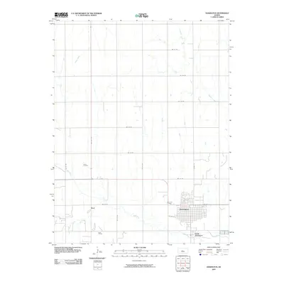
2009 Map of Hoisington
USGS Topo · Published 2009About this map
Hoisington serves as the central hub for this Barton County landscape, where the town's organized grid meets the sprawling agricultural and industrial tracts of central Kansas. The map captures the significant economic presence of the Boyd Oil Field located just south of the settlement of Boyd, illustrating the intersection of energy production and rural life. Water management is defined by the winding paths of Blood Creek, which flows past South Hoisington, alongside Sellers Creek and Deception Creek to the north. Historical and genealogical interest is found at Saint John Cemetery on the outskirts of the main town and Olivet Cemetery further west. A rigid network of section-line roads, such as NW 110 RD and NW 40th Ave, underscores the region's systematic land division and its enduring identity as a farming and petroleum corridor.
Find a feature on this map
24 named features on this map. Tap any name to fly to it.
Don’t see what you’re looking for? This feature index may not catch every label — zoom into the map to look around manually.
Map Details
Editions of this 2009 Hoisington Map
This is the sole edition of this map. No revisions or reprints were ever made.
Other maps of this area

1891 · Great Bend
USGS Topo · 1:125,000

1893 · Great Bend
USGS Topo · 1:125,000

1896 · Russell
USGS Topo · 1:125,000

1955 · Great Bend
USGS Topo · 1:250,000

1956 · Ellinwood NW
USGS Topo · 1:24,000

1957 · Great Bend
USGS Topo · 1:250,000

1958 · Great Bend
USGS Topo · 1:250,000

1959 · Great Bend NE
USGS Topo · 1:24,000
1960 · Heizer
USGS Topo · 1:24,000
1969 · Olmitz
USGS Topo · 1:24,000