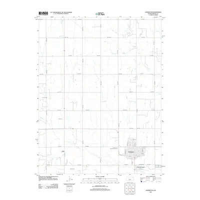
2012 Map of Hoisington
USGS Topo · Published 2012About this map
Hoisington serves as the primary hub of this central Kansas landscape, with its residential grid extending from N Main St and Gould St. The town's proximity to South Hoisington and the smaller settlement of Boyd to the southwest highlights a regional layout defined by energy production and agriculture. Industrial activity is prominent in the surrounding prairie, notably at the Carroll Oil Field and Boyd Oil Field, which illustrate the area's economic reliance on subsurface resources.
Find a feature on this map
47 named features on this map. Tap any name to fly to it.
Don’t see what you’re looking for? This feature index may not catch every label — zoom into the map to look around manually.
Map Details
Editions of this 2012 Hoisington Map
This is the sole edition of this map. No revisions or reprints were ever made.
Other maps of this area

1891 · Great Bend
USGS Topo · 1:125,000

1893 · Great Bend
USGS Topo · 1:125,000

1896 · Russell
USGS Topo · 1:125,000

1955 · Great Bend
USGS Topo · 1:250,000

1956 · Ellinwood NW
USGS Topo · 1:24,000

1957 · Great Bend
USGS Topo · 1:250,000

1958 · Great Bend
USGS Topo · 1:250,000

1959 · Great Bend NE
USGS Topo · 1:24,000
1960 · Heizer
USGS Topo · 1:24,000
1969 · Olmitz
USGS Topo · 1:24,000