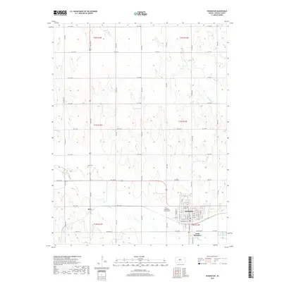
2018 Map of Hoisington
USGS Topo · Published 2018About this map
Hoisington occupies the center of this 2018 survey, appearing as a significant local hub defined by a rigorous grid of streets like W 15th St and E 1st St. The surrounding Barton County landscape is shaped by the winding courses of Blood Creek, Deception Creek, and Sellens Creek, which cut through the high plains terrain. Local history and genealogy are anchored by features such as Saint John the Evangelist Catholic Cem on the outskirts of the primary settlement and Oliver Cem to the west. Small communities like Boyd and South Hoisington reflect the decentralized nature of these agricultural lands, while a dense network of sectional roads, including Keystone Rd and NW 180 Rd, illustrates the enduring structure of the township and range surveying system in this part of Kansas.
Find a feature on this map
48 named features on this map. Tap any name to fly to it.
Don’t see what you’re looking for? This feature index may not catch every label — zoom into the map to look around manually.
Map Details
Editions of this 2018 Hoisington Map
This is the sole edition of this map. No revisions or reprints were ever made.
Other maps of this area

1891 · Great Bend
USGS Topo · 1:125,000

1893 · Great Bend
USGS Topo · 1:125,000

1896 · Russell
USGS Topo · 1:125,000

1955 · Great Bend
USGS Topo · 1:250,000

1956 · Ellinwood NW
USGS Topo · 1:24,000

1957 · Great Bend
USGS Topo · 1:250,000

1958 · Great Bend
USGS Topo · 1:250,000

1959 · Great Bend NE
USGS Topo · 1:24,000
1960 · Heizer
USGS Topo · 1:24,000
1969 · Olmitz
USGS Topo · 1:24,000