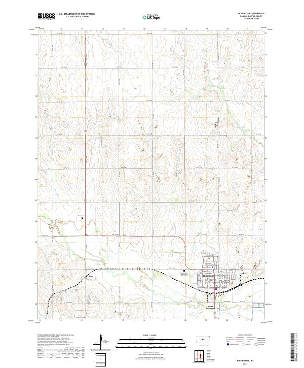
2022 Map of Hoisington
USGS Topo · Published 2022About this map
Hoisington serves as the central hub of this Barton County landscape, where the grid of a modern township meets the winding drainage of the Great Plains. The topography is defined by the subtle valleys of Blood Cr, Sellens Cr, and Deception Cr, which carve through the agricultural sections. To the west, the small settlement of Boyd sits along the roadway, while South Hoisington extends the residential footprint below the main town center. Genealogy and local history are anchored by sites such as Olivet Cem and the Saint John the Evangelist Catholic Cem. This 2022 survey documents the contemporary arrangement of rural section roads, from NW 180 Rd down to Keystone Rd, illustrating the enduring importance of the rectangular survey system in Kansas land management and local navigation.
Find a feature on this map
57 named features on this map. Tap any name to fly to it.
Don’t see what you’re looking for? This feature index may not catch every label — zoom into the map to look around manually.
Map Details
Editions of this 2022 Hoisington Map
This is the sole edition of this map. No revisions or reprints were ever made.
Other maps of this area

1891 · Great Bend
USGS Topo · 1:125,000

1893 · Great Bend
USGS Topo · 1:125,000

1896 · Russell
USGS Topo · 1:125,000

1955 · Great Bend
USGS Topo · 1:250,000

1956 · Ellinwood NW
USGS Topo · 1:24,000

1957 · Great Bend
USGS Topo · 1:250,000

1958 · Great Bend
USGS Topo · 1:250,000

1959 · Great Bend NE
USGS Topo · 1:24,000
1960 · Heizer
USGS Topo · 1:24,000
1969 · Olmitz
USGS Topo · 1:24,000