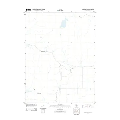
2012 Map of Holbrook Canyon
USGS Topo · Published 2012About this map
Holbrook Canyon and the high desert terrain of Lassen County define this 2012 landscape, where water sources dictate the patterns of human and livestock presence. Numerous springs such as Clover Springs, Stipa Spring, and Tanner Spring are scattered across the quadrangle, feeding vital catchments like the Nelson Corral Reservoir and Spooner Reservoir. These water features highlight the necessity of resource management in the arid corridor between Anderson Mountain and the expansive Madeline Plains.
Find a feature on this map
32 named features on this map. Tap any name to fly to it.
Don’t see what you’re looking for? This feature index may not catch every label — zoom into the map to look around manually.
Map Details
Editions of this 2012 Holbrook Canyon Map
This is the sole edition of this map. No revisions or reprints were ever made.
Other maps of this area

1886 · Alturas
USGS Topo · 1:250,000

1886 · Honey Lake
USGS Topo · 1:250,000

1891 · Honey Lake
USGS Topo · 1:250,000

1892 · Alturas
USGS Topo · 1:250,000

1893 · Honey Lake
USGS Topo · 1:250,000

1954 · Grasshopper Valley
USGS Topo · 1:62,500

1954 · Ravendale
USGS Topo · 1:62,500

1954 · Alturas
USGS Topo · 1:250,000

1955 · Westwood
USGS Topo · 1:250,000

1958 · Alturas
USGS Topo · 1:250,000