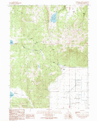
1990 Map of Holbrook Canyon
USGS Topo · Published 1990About this map
Anderson Mountain dominates the southwestern corner of this high-desert landscape in Lassen County, dropping sharply toward the expansive Madeline Plains. The terrain is defined by a series of flats and canyons where water management is critical to ranching life. Small storage basins such as Nelson Corral Reservoir and Spooner Reservoir capture seasonal runoff, while named water sources like Bill Allen Spring and North Tanner Spring punctuate the arid slopes. The presence of the Williams Ranch near the center of the sheet indicates the area's continued reliance on livestock grazing. To the north, Harter Flat and Sagebrush Flat provide relatively level ground between the more complex drainage systems of Holbrook Canyon and Anderson Canyon. This provisional survey reflects the land-use patterns of the late 20th century in northeastern California.
Find a feature on this map
22 named features on this map. Tap any name to fly to it.
Don’t see what you’re looking for? This feature index may not catch every label — zoom into the map to look around manually.
Map Details
Editions of this 1990 Holbrook Canyon Map
This is the sole edition of this map. No revisions or reprints were ever made.
Other maps of this area

1886 · Alturas
USGS Topo · 1:250,000

1886 · Honey Lake
USGS Topo · 1:250,000

1891 · Honey Lake
USGS Topo · 1:250,000

1892 · Alturas
USGS Topo · 1:250,000

1893 · Honey Lake
USGS Topo · 1:250,000

1954 · Grasshopper Valley
USGS Topo · 1:62,500

1954 · Ravendale
USGS Topo · 1:62,500

1954 · Alturas
USGS Topo · 1:250,000

1955 · Westwood
USGS Topo · 1:250,000

1958 · Alturas
USGS Topo · 1:250,000