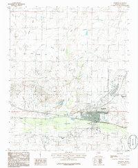
1986 Map of Holbrook
USGS Topo · Published 1986About this map
The Little Colorado River defines the southern edge of Holbrook in this mid-1980s survey, showing a desert crossroads in transition. The map captures the organized grid of the town site alongside significant regional infrastructure like the Municipal Airport and the campus of Northland Pioneer College. Water management is evident through the extensive system of levees flanking the Little Colorado River and the various drainages such as Leroux Wash and Jacobs Wash that feed toward the valley floor.
Find a feature on this map
18 named features on this map. Tap any name to fly to it.
Don’t see what you’re looking for? This feature index may not catch every label — zoom into the map to look around manually.
Map Details
Editions of this 1986 Holbrook Map
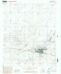
2 editions found
Other maps of this area

1883 · Tusayan
USGS Topo · 1:250,000

1886 · Tusayan
USGS Topo · 1:250,000

1886 · Holbrook
USGS Topo · 1:250,000

1893 · Holbrook
USGS Topo · 1:250,000

1947 · Flagstaff
USGS Topo · 1:250,000

1954 · Flagstaff
USGS Topo · 1:250,000

1954 · Holbrook
USGS Topo · 1:250,000

1955 · St. Joseph 1 NE
USGS Topo · 1:24,000

1955 · St. Joseph 2 SE
USGS Topo · 1:24,000

1955 · St. Joseph 1 SE
USGS Topo · 1:24,000
Featured Places
- Holbrook, AZ
- Clearview Heights, Holbrook
- Lisitzky Subdivision, Holbrook
- Rosedale Heights, Holbrook
- Sierra Plaza subdivision, Holbrook