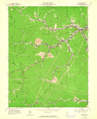
1963 Map of Holden
USGS Topo · Published 1964About this map
Holden and the surrounding coal country of Logan County are defined by deep-cut hollows and a dense network of mining settlements along the Mud River and Island Creek drainage. The Chesapeake and Ohio railway lines thread through these narrow valleys, connecting industrial clusters like Whitman Junction and Trace Junction to the larger Appalachian network. The map reveals the social fabric of the era through dozens of small community markers, including local schools like Whitman School and landmarks such as the Logan Branch Marshall University. From Black Bottom to Mount Gay, the landscape is a mix of residential additions and extractive industry, evidenced by numerous Mine Dump labels. In the more secluded southern reaches, family-named sites like the Ooten Cemetery and Pickering Knob punctuate the ridges, while the Chief Logan State Recreation Area occupies the northern heights.
Find a feature on this map
86 named features on this map. Tap any name to fly to it.
Don’t see what you’re looking for? This feature index may not catch every label — zoom into the map to look around manually.
Map Details
Editions of this 1963 Holden Map
3 editions found
Other maps of this area

1887 · Warfield
USGS Topo · 1:125,000

1891 · Oceana
USGS Topo · 1:125,000

1891 · Warfield
USGS Topo · 1:125,000

1893 · Oceana
USGS Topo · 1:125,000

1898 · Oceana
USGS Topo · 1:125,000

1909 · Matewan
USGS Topo · 1:48,000

1909 · Gilbert
USGS Topo · 1:48,000

1910 · Holden
USGS Topo · 1:48,000

1912 · Gilbert
USGS Topo · 1:62,500

1912 · Holden
USGS Topo · 1:62,500