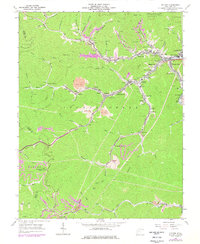
1963 Map of Holden
USGS Topo · Published 1977About this map
The Guyan River and the winding Island Creek drainage define the rugged topography of this coal-country map, where narrow valleys dictate the layout of industrial and residential life. Major mining operations are evident through numerous strip mines and mine dumps that mark the hillsides, particularly near Holden and Verdunville. The infrastructure of the coal economy is clear, following the Chesapeake and Ohio rail lines as they thread through hollows to reach dozens of small settlements like Whitman Junction, Thompson Town, and Shamrock.
Find a feature on this map
94 named features on this map. Tap any name to fly to it.
Don’t see what you’re looking for? This feature index may not catch every label — zoom into the map to look around manually.
Map Details
Editions of this 1963 Holden Map
3 editions found
Other maps of this area

1887 · Warfield
USGS Topo · 1:125,000

1891 · Oceana
USGS Topo · 1:125,000

1891 · Warfield
USGS Topo · 1:125,000

1893 · Oceana
USGS Topo · 1:125,000

1898 · Oceana
USGS Topo · 1:125,000

1909 · Matewan
USGS Topo · 1:48,000

1909 · Gilbert
USGS Topo · 1:48,000

1910 · Holden
USGS Topo · 1:48,000

1912 · Gilbert
USGS Topo · 1:62,500

1912 · Holden
USGS Topo · 1:62,500