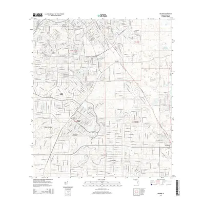
2015 Map of Holder
USGS Topo · Published 2015About this map
Citrus Springs and Pine Ridge represent the suburban expansion into Citrus County's interior during the early 21st century. This landscape is defined by the transition from rural woodlands to master-planned communities, where dense residential street grids contrast sharply with the open water of Twomile Prairie Lake and the wetlands bordering Tsala Apopka Lake. The Florida National Scenic Trail winds through the central corridor, providing a preserved natural transect amidst the developing residential blocks of Beverly Hills and Citrus Hills. Local genealogy and history are anchored by long-standing landmarks like Burke Cem and the Hernando Cem, which sit alongside more modern developments such as the Black Diamond community and Beverly Hills Memorial Gardens.
Find a feature on this map
17 named features on this map. Tap any name to fly to it.
Don’t see what you’re looking for? This feature index may not catch every label — zoom into the map to look around manually.
Map Details
Editions of this 2015 Holder Map
This is the sole edition of this map. No revisions or reprints were ever made.
Other maps of this area

1892 · Dunnellon
USGS Topo · 1:62,500

1894 · Dunnellon
USGS Topo · 1:62,500

1895 · Tsala Apopka
USGS Topo · 1:62,500

1954 · Lecanto
USGS Topo · 1:24,000

1954 · Homosassa
USGS Topo · 1:24,000

1954 · Holder
USGS Topo · 1:24,000

1954 · Crystal River
USGS Topo · 1:24,000

1954 · Tsala Apopka NE
USGS Topo · 1:24,000

1954 · Dunnellon
USGS Topo · 1:24,000

1954 · Inverness
USGS Topo · 1:24,000