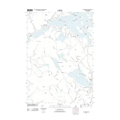
2012 Map of Holderness
USGS Topo · Published 2012About this map
Squam Lake dominates this 2012 topography, illustrating the dense archipelago of central New Hampshire. The map details a complex shoreline featuring Great Island, Bowman Island, and Kimball Island, alongside the smaller settlements of Holderness and East Holderness. This era shows a landscape where historic lakeside living meets modern recreation, evidenced by the presence of both the Squam Bridge Cem and the Waukewan Golf Course.
Find a feature on this map
147 named features on this map. Tap any name to fly to it.
Don’t see what you’re looking for? This feature index may not catch every label — zoom into the map to look around manually.
Map Details
Editions of this 2012 Holderness Map
This is the sole edition of this map. No revisions or reprints were ever made.
Other maps of this area

1909 · Winnepesaukee
USGS Topo · 1:62,500

1925 · Holderness
USGS Topo · 1:62,500

1927 · Holderness
USGS Topo · 1:62,500

1928 · Plymouth
USGS Topo · 1:62,500

1931 · Plymouth
USGS Topo · 1:62,500

1931 · Mt. Chocorua
USGS Topo · 1:62,500

1949 · Portland
USGS Topo · 1:250,000

1956 · Winnipesaukee
USGS Topo · 1:62,500

1956 · Holderness
USGS Topo · 1:62,500

1956 · Portland
USGS Topo · 1:250,000