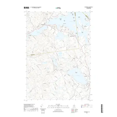
2018 Map of Holderness
USGS Topo · Published 2018About this map
Squam Lake and its intricate network of islands and coves dominate this 2018 survey of the Lakes Region. The village of Holderness serves as a central hub between the larger lake and Little Squam Lake, where the Squam Bridge Cem and Squam River Bridge anchor the local geography. The landscape is defined by significant elevations like Cotton Mtn and Shepard Hill, which rise above the water-rich terrain of White Oak Pond and Winona Lake. To the southeast, the settlement of Meredith borders Lake Waukewan, showing the continued importance of these glacial basins to New Hampshire's residential and recreation patterns. Genealogists will find interest in the road networks connecting East Holderness and Winona, where family-named routes like Perkins Farm Ln and Bartlett Hill Rd navigate the hills of Belknap and Grafton counties.
Find a feature on this map
144 named features on this map. Tap any name to fly to it.
Don’t see what you’re looking for? This feature index may not catch every label — zoom into the map to look around manually.
Map Details
Editions of this 2018 Holderness Map
This is the sole edition of this map. No revisions or reprints were ever made.
Other maps of this area

1909 · Winnepesaukee
USGS Topo · 1:62,500

1925 · Holderness
USGS Topo · 1:62,500

1927 · Holderness
USGS Topo · 1:62,500

1928 · Plymouth
USGS Topo · 1:62,500

1931 · Plymouth
USGS Topo · 1:62,500

1931 · Mt. Chocorua
USGS Topo · 1:62,500

1949 · Portland
USGS Topo · 1:250,000

1956 · Winnipesaukee
USGS Topo · 1:62,500

1956 · Holderness
USGS Topo · 1:62,500

1956 · Portland
USGS Topo · 1:250,000