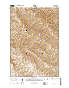
2014 Map of Holdman
USGS Topo · Published 2014About this map
Holdman and Stage Gulch anchor this rural landscape in northeastern Oregon, where the terrain is deeply carved by a network of drainage systems. The northern portion of the map is dominated by the converging branches of South Fork Cold Springs Canyon, Middle Fork Cold Springs Canyon, and North Fork Cold Springs Canyon. These canyons dictate the local road network, with Or-37 winding through the topography alongside Cold Springs Canyon.
Find a feature on this map
25 named features on this map. Tap any name to fly to it.
Don’t see what you’re looking for? This feature index may not catch every label — zoom into the map to look around manually.
Map Details
Editions of this 2014 Holdman Map
This is the sole edition of this map. No revisions or reprints were ever made.
Other maps of this area

1908 · Umatilla
USGS Topo · 1:125,000

1935 · Pendleton
USGS Topo · 1:125,000

1953 · Pendleton
USGS Topo · 1:250,000

1956 · Pendleton
USGS Topo · 1:250,000

1962 · Juniper
USGS Topo · 1:24,000

1962 · Stanfield SE
USGS Topo · 1:24,000
1966 · Juniper Canyon
USGS Topo · 1:24,000

1966 · Holdman
USGS Topo · 1:24,000

1966 · Holdman SE
USGS Topo · 1:24,000

1966 · Pendleton
USGS Topo · 1:24,000