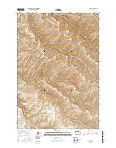
2017 Map of Holdman
USGS Topo · Published 2017About this map
Holdman serves as the focal point of this rural Umatilla County landscape, where the high desert terrain is defined by a series of deep drainage systems. The map detail highlights the intersection of local history and topography, particularly through the location of the Holdman Cem and the more remote Despain Gulch Cem to the south. These sites, along with family-named routes like Bissinger Rd and Weidert Rd, reflect the early settlement patterns of this agricultural region. The land is heavily dissected by significant geological features including Cold Springs Canyon and the winding paths of Missouri Gulch and Despain Gulch. The road network, including S Cold Springs Rd and the Stage Gulch Rd, follows the natural contours of the canyons, illustrating how the physical geography dictated early transportation and access throughout this part of Oregon.
Find a feature on this map
24 named features on this map. Tap any name to fly to it.
Don’t see what you’re looking for? This feature index may not catch every label — zoom into the map to look around manually.
Map Details
Editions of this 2017 Holdman Map
This is the sole edition of this map. No revisions or reprints were ever made.
Other maps of this area

1908 · Umatilla
USGS Topo · 1:125,000

1935 · Pendleton
USGS Topo · 1:125,000

1953 · Pendleton
USGS Topo · 1:250,000

1956 · Pendleton
USGS Topo · 1:250,000

1962 · Juniper
USGS Topo · 1:24,000

1962 · Stanfield SE
USGS Topo · 1:24,000
1966 · Juniper Canyon
USGS Topo · 1:24,000

1966 · Holdman
USGS Topo · 1:24,000

1966 · Holdman SE
USGS Topo · 1:24,000

1966 · Pendleton
USGS Topo · 1:24,000