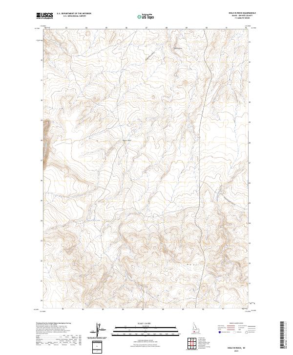
2023 Map of Hole In Rock
USGS Topo · Published 2023About this map
Big Jacks Creek Wilderness defines the western edge of this Owyhee County landscape, where the Big Jacks Creek Wild and Scenic River carves through the high desert plateau. This high-altitude terrain is marked by distinctive geological formations like the Black Rocks and the prominent Big Hill in the southeast. Water is a scarce but critical resource in this arid environment, represented by the ephemeral Deadman Gulch and the isolated Hole-in-Rock Lake. The human footprint is sparse, primarily traced by the evocative Broken Wagon Trail Rd, a name that suggests the difficult passage encountered by early travelers through this portion of Idaho. Surveyed in the early 21st century, the map details the Township and Range system across the high plains, centered on the Hole in Rock landmark.
Find a feature on this map
12 named features on this map. Tap any name to fly to it.
Don’t see what you’re looking for? This feature index may not catch every label — zoom into the map to look around manually.
Map Details
Editions of this 2023 Hole In Rock Map
This is the sole edition of this map. No revisions or reprints were ever made.
Other maps of this area

1947 · Little Valley
USGS Topo · 1:24,000

1947 · Grand View
USGS Topo · 1:62,500

1947 · Bruneau
USGS Topo · 1:62,500

1947 · Sugar Valley
USGS Topo · 1:24,000

1947 · Chalk Hills
USGS Topo · 1:24,000
1948 · Little Valley
USGS Topo · 1:24,000
1948 · Chalk Hills
USGS Topo · 1:24,000

1948 · Sugar Valley
USGS Topo · 1:24,000

1955 · Jordan Valley
USGS Topo · 1:250,000

1955 · Twin Falls
USGS Topo · 1:250,000