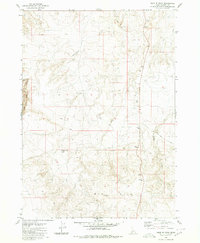
1980 Map of Hole In Rock
USGS Topo · Published 1980About this map
Hole In Rock and the surrounding high desert of Owyhee County are defined by a complex network of drainage systems and resource extraction sites. In the southern portion of the quadrangle, Big Hill rises as a dominant landform, while the namesake Hole in Rock Lake provides a rare water feature in this arid landscape. The map reveals a land utilized for more than just ranching, as evidenced by the presence of Missile Base Road cutting across the eastern sections.
Find a feature on this map
14 named features on this map. Tap any name to fly to it.
Don’t see what you’re looking for? This feature index may not catch every label — zoom into the map to look around manually.
Map Details
Editions of this 1980 Hole In Rock Map
This is the sole edition of this map. No revisions or reprints were ever made.
Other maps of this area

1947 · Little Valley
USGS Topo · 1:24,000

1947 · Grand View
USGS Topo · 1:62,500

1947 · Bruneau
USGS Topo · 1:62,500

1947 · Sugar Valley
USGS Topo · 1:24,000

1947 · Chalk Hills
USGS Topo · 1:24,000
1948 · Little Valley
USGS Topo · 1:24,000
1948 · Chalk Hills
USGS Topo · 1:24,000

1948 · Sugar Valley
USGS Topo · 1:24,000

1955 · Jordan Valley
USGS Topo · 1:250,000

1955 · Twin Falls
USGS Topo · 1:250,000