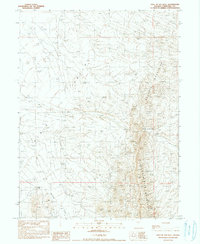
1990 Map of Hole In The Wall
USGS Topo · Published 1990About this map
Augusta Mountains and the Clan Alpine Mountains meet in this high-desert landscape of Churchill County, dominated by the namesake Hole in the Wall geological pass. The terrain is defined by its isolation and limited accessibility, where drainage is primarily channeled through Shoshone Creek and various wash areas. The 1990 survey reflects a region primarily used for grazing or mineral exploration, as indicated by the network of 4wd tracks that represent the only infrastructure through the broad Valley. This provisional edition captures the precise topography of the Great Basin's basin-and-range province, documenting a moment in time when the landscape remained largely undeveloped and reliant on seasonal water sources and primitive routes for navigation.
Find a feature on this map
9 named features on this map. Tap any name to fly to it.
Don’t see what you’re looking for? This feature index may not catch every label — zoom into the map to look around manually.
Map Details
Editions of this 1990 Hole In The Wall Map
This is the sole edition of this map. No revisions or reprints were ever made.
Other maps of this area

1932 · Sonoma Range
USGS Topo · 1:250,000

1939 · Sonoma Range
USGS Topo · 1:250,000

1955 · Millett
USGS Topo · 1:250,000

1955 · Winnemucca
USGS Topo · 1:250,000

1958 · Winnemucca
USGS Topo · 1:250,000

1959 · Millett
USGS Topo · 1:250,000

1961 · Cain Mountain
USGS Topo · 1:62,500

1961 · Fencemaker
USGS Topo · 1:62,500

1962 · Winnemucca
USGS Topo · 1:250,000

1966 · Humboldt Salt Marsh
USGS Topo · 1:62,500