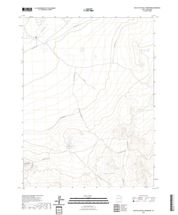
2023 Map of Hole-in-the-Wall Reservoir
USGS Topo · Published 2023About this map
Hole-in-the-Wall Reservoir lies at the heart of this high-desert landscape in Juab County, Utah. The terrain is characterized by isolated formations and arid basins, notably the Smelter Knolls and the sprawling Middle Range. The presence of Granite Ranch Rd and Rocky Flat Loop suggests a history of livestock grazing and remote land management typical of the eastern Great Basin. Small, ephemeral water sources like Granite Creek provide critical drainage through the undulating hills.
Find a feature on this map
15 named features on this map. Tap any name to fly to it.
Don’t see what you’re looking for? This feature index may not catch every label — zoom into the map to look around manually.
Map Details
Editions of this 2023 Hole-in-the-Wall Reservoir Map
This is the sole edition of this map. No revisions or reprints were ever made.
Other maps of this area

1908 · Fish Springs
USGS Topo · 1:250,000

1910 · Fish Springs
USGS Topo · 1:250,000

1953 · Delta
USGS Topo · 1:250,000

1958 · Delta
USGS Topo · 1:250,000

1960 · Granite Mountain
USGS Topo · 1:62,500

1961 · Trout Creek
USGS Topo · 1:62,500

1962 · Delta
USGS Topo · 1:250,000

1972 · Mud Lake Reservoir
USGS Topo · 1:24,000
1972 · Boyd Station
USGS Topo · 1:24,000
1972 · Indian Farm Creek
USGS Topo · 1:24,000