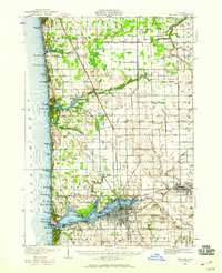
1929 Map of Holland
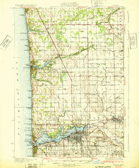
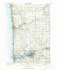
USGS Topo · Published 1965About this map
Holland and its surrounding lakefront communities thrive along the eastern shore of Lake Michigan during the late 1920s, showing a landscape defined by resort culture and rural education. The shoreline is dotted with established summer destinations like Ottawa Beach, Macatawa, and Zwemmer Beach, while more specialized properties such as the Getz Lakewood Farm and Wakantanka Lodge occupy the dunes and woods north of the city. The interior is a dense network of township sections served by numerous local schools, including Twentyfourth Street Sch, Waukazoo Sch, and Pigeon Creek Sch. Transport is dominated by the Pere Marquette railroad, which links the lakefront to agricultural hubs like West Olive and Harlem. This survey captures the region just as the automotive age began to formalize lakefront access, though many areas like the Olive Hills still retain their natural topography between the developed park systems like Waukazoo Park and Jenison Park.
Find a feature on this map
113 named features on this map. Tap any name to fly to it.
Don’t see what you’re looking for? This feature index may not catch every label — zoom into the map to look around manually.
Map Details
Editions of this 1929 Holland Map
2 editions found