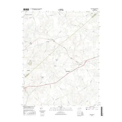
2016 Map of Holland
USGS Topo · Published 2016About this map
Carrsville and Elwood anchor this landscape along the boundary between the City of Suffolk and Isle of Wight County. The terrain is defined by an extensive network of wetlands, including the wide reaches of Beaverdam Swamp and Kingsale Swamp. These natural drainage systems have long dictated the placement of local thoroughfares like S Quay Rd and Ruritan Blvd, which skirt the lower-lying areas to connect smaller clusters of settlement.
Find a feature on this map
64 named features on this map. Tap any name to fly to it.
Don’t see what you’re looking for? This feature index may not catch every label — zoom into the map to look around manually.
Map Details
Editions of this 2016 Holland Map
This is the sole edition of this map. No revisions or reprints were ever made.
Other maps of this area

1919 · Smithfield
USGS Topo · 1:62,500

1919 · Suffolk
USGS Topo · 1:62,500

1920 · Holland
USGS Topo · 1:62,500

1920 · Ivor
USGS Topo · 1:62,500

1943 · Holland
USGS Topo · 1:62,500

1944 · Windsor
USGS Topo · 1:31,680

1944 · Sedley
USGS Topo · 1:24,000

1944 · Zuni
USGS Topo · 1:24,000

1945 · Zuni
USGS Topo · 1:31,680
1945 · Sedley
USGS Topo · 1:31,680