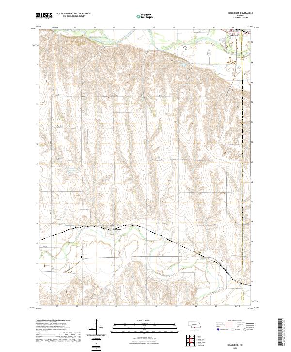
2021 Map of Hollinger
USGS Topo · Published 2021About this map
The Republican River valley landscape near the eastern edge of Furnas County centers on the village of Hollinger, a small settlement along the section lines of southern Nebraska. Just to the northeast, the larger town of Oxford sits at the intersection of local routes like Cornwall St, serving as a regional hub near the Furnas-Harlan county line. The topography is defined by the winding course of Beaver Creek, which cuts through the southern portion of the quadrangle, while the northern uplands are punctuated by local water features including Cadwalder Reservoir and Sturtevant Reservoir. Genealogists will find the Turner Cem north of the creek, a key site for documenting the area's agricultural families. The map reflects a deeply established rural infrastructure, organized by an extensive grid of section roads from Rd 711 to Rd 717 that delineate the high plains farming territory.
Find a feature on this map
28 named features on this map. Tap any name to fly to it.
Don’t see what you’re looking for? This feature index may not catch every label — zoom into the map to look around manually.
Map Details
Editions of this 2021 Hollinger Map
This is the sole edition of this map. No revisions or reprints were ever made.
Other maps of this area

1896 · Arapahoe
USGS Topo · 1:125,000

1898 · Arapahoe
USGS Topo · 1:125,000

1955 · Grand Island
USGS Topo · 1:250,000

1957 · Grand Island
USGS Topo · 1:250,000

1957 · Precept
USGS Topo · 1:24,000

1957 · Beaver City SE
USGS Topo · 1:24,000

1957 · Stamford SE
USGS Topo · 1:24,000

1958 · Grand Island
USGS Topo · 1:250,000

1958 · Edison
USGS Topo · 1:24,000

1958 · Hollinger
USGS Topo · 1:24,000