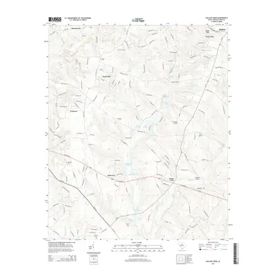
2014 Map of Hollow Creek
USGS Topo · Published 2014About this map
Burnettown and the surrounding Aiken County landscape appear here in a transition between residential growth and rural heritage. The map records several family-named burial grounds, including Glover Cem, Saint Marks Cem, and Galphin Cem, which offer significant value for genealogists tracing local lineages. The settlement of Spiderweb sits near the central portion of the map, while the community of Hollow Creek occupies the lower right, reflecting the area's distributed population centers. Water features like Lower McElmurray Lake, Burgess Lake, and Lake Johnsons suggest a landscape defined by small impoundments and creek drainages. Small-scale aviation is represented by Harman Airport, and the presence of places like Stone Gap and Russell Hill indicates the varying terrain of the South Carolina sandhills. This edition provides a record of the modern road network, including SC-302 and Williston Rd, overlaying a historically agricultural and residential region.
Find a feature on this map
137 named features on this map. Tap any name to fly to it.
Don’t see what you’re looking for? This feature index may not catch every label — zoom into the map to look around manually.
Map Details
Editions of this 2014 Hollow Creek Map
This is the sole edition of this map. No revisions or reprints were ever made.
Other maps of this area

1920 · Aiken
USGS Topo · 1:48,000

1920 · Talatha
USGS Topo · 1:48,000

1921 · Augusta
USGS Topo · 1:62,500

1921 · Aiken
USGS Topo · 1:62,500

1921 · Talatha
USGS Topo · 1:62,500

1923 · Warrenville
USGS Topo · 1:48,000

1928 · Warrenville
USGS Topo · 1:62,500

1943 · Aiken
USGS Topo · 1:62,500

1943 · Augusta East
USGS Topo · 1:125,000

1943 · Warrenville
USGS Topo · 1:62,500