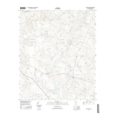
2017 Map of Hollow Creek
USGS Topo · Published 2017About this map
Burnettown and the surrounding Aiken County countryside are captured here in a period of modern residential growth and shifting land use. The terrain is defined by a dense network of streams and ponds, including Town Cr and the waters of Lower McElmurray Lake. A distinctive feature of the area is its collection of small, family-named burial sites, such as Glover Cem, Saint Marks Cem, and Hankinson Cem, which serve as vital touchstones for genealogists researching the region's heritage. The map documents the layout of established settlements like Spiderweb and Hollow Creek alongside more recent developments represented by a web of local roads such as Rabbitfoot Ln and Sugar Cane Ct. From the Harman Airport to the recreational Boyd Pond Singletrack, the landscape reflects a transition from traditional rural South Carolina life to more contemporary utility and leisure.
Find a feature on this map
135 named features on this map. Tap any name to fly to it.
Don’t see what you’re looking for? This feature index may not catch every label — zoom into the map to look around manually.
Map Details
Editions of this 2017 Hollow Creek Map
This is the sole edition of this map. No revisions or reprints were ever made.
Other maps of this area

1920 · Aiken
USGS Topo · 1:48,000

1920 · Talatha
USGS Topo · 1:48,000

1921 · Augusta
USGS Topo · 1:62,500

1921 · Aiken
USGS Topo · 1:62,500

1921 · Talatha
USGS Topo · 1:62,500

1923 · Warrenville
USGS Topo · 1:48,000

1928 · Warrenville
USGS Topo · 1:62,500

1943 · Aiken
USGS Topo · 1:62,500

1943 · Augusta East
USGS Topo · 1:125,000

1943 · Warrenville
USGS Topo · 1:62,500