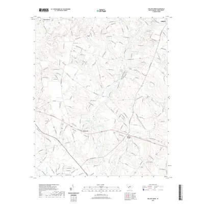
2020 Map of Hollow Creek
USGS Topo · Published 2020About this map
Hollow Creek and the surrounding Aiken County landscape appear here as a patchwork of family-named cemeteries and complex water systems. Small settlements like Burnettown and the uniquely named Spiderweb anchor the road network, while the terrain is defined by drainage features such as Graymare Hollow and the flow of Town Creek and Long Branch. The map reveals a high density of rural burial grounds, including the Glover Cemetery, Saint Marks Cemetery, and Galphin Cemetery, which provide essential touchstones for local genealogical research.
Find a feature on this map
168 named features on this map. Tap any name to fly to it.
Don’t see what you’re looking for? This feature index may not catch every label — zoom into the map to look around manually.
Map Details
Editions of this 2020 Hollow Creek Map
This is the sole edition of this map. No revisions or reprints were ever made.
Other maps of this area

1920 · Aiken
USGS Topo · 1:48,000

1920 · Talatha
USGS Topo · 1:48,000

1921 · Augusta
USGS Topo · 1:62,500

1921 · Aiken
USGS Topo · 1:62,500

1921 · Talatha
USGS Topo · 1:62,500

1923 · Warrenville
USGS Topo · 1:48,000

1928 · Warrenville
USGS Topo · 1:62,500

1943 · Aiken
USGS Topo · 1:62,500

1943 · Augusta East
USGS Topo · 1:125,000

1943 · Warrenville
USGS Topo · 1:62,500