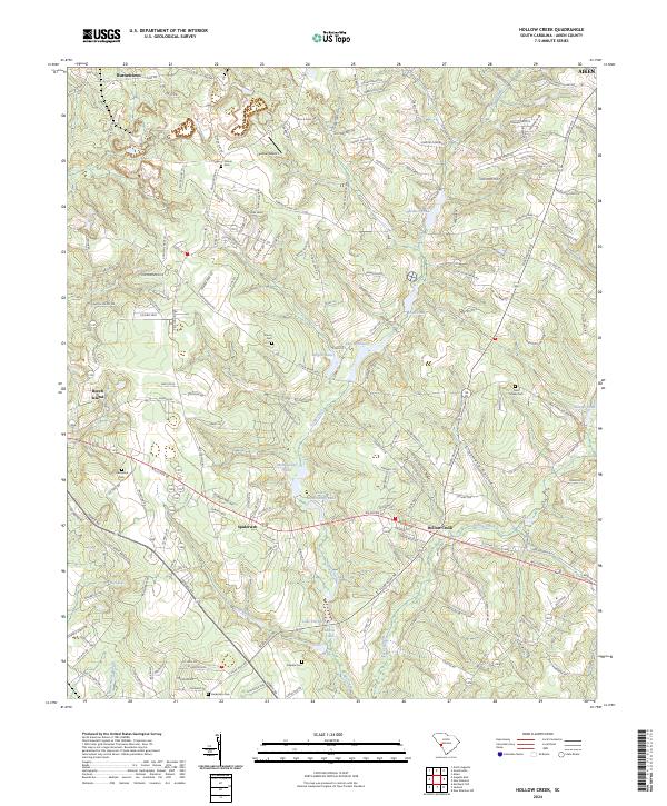
2024 Map of Hollow Creek
USGS Topo · Published 2024About this map
Town Creek and its many tributaries carve through this section of South Carolina, creating a complex drainage system that feeds several notable water bodies including Lake Johnsons, Burgess Lake, and Lower McElmurray Lake. The landscape is a mix of small settlements like Spiderweb, Beech Island, and Hollow Creek, interspersed with significant family landmarks. For those studying local lineage, the map identifies several burial grounds such as Glover Cem, Saint Marks Cem, and Galphin Cem.
Find a feature on this map
175 named features on this map. Tap any name to fly to it.
Don’t see what you’re looking for? This feature index may not catch every label — zoom into the map to look around manually.
Map Details
Editions of this 2024 Hollow Creek Map
This is the sole edition of this map. No revisions or reprints were ever made.
Other maps of this area

1920 · Aiken
USGS Topo · 1:48,000

1920 · Talatha
USGS Topo · 1:48,000

1921 · Augusta
USGS Topo · 1:62,500

1921 · Aiken
USGS Topo · 1:62,500

1921 · Talatha
USGS Topo · 1:62,500

1923 · Warrenville
USGS Topo · 1:48,000

1928 · Warrenville
USGS Topo · 1:62,500

1943 · Aiken
USGS Topo · 1:62,500

1943 · Augusta East
USGS Topo · 1:125,000

1943 · Warrenville
USGS Topo · 1:62,500