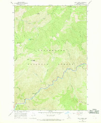
1966 Map of Holly Creek
USGS Topo · Published 1969About this map
The Lochsa River winds through the heart of the Clearwater National Forest in this mid-1960s survey, providing a snapshot of the Idaho wilderness before modern development. This landscape is defined by its dramatic relief and a network of historic pathways, most notably the Lolo Trail and various Pack Trails that snake across the ridgelines. High-elevation points like Indian Grave Peak and Castle Butte, which features a Lookout Sta, overlook a series of drainages including Holly Creek and Castle Creek.
Find a feature on this map
26 named features on this map. Tap any name to fly to it.
Don’t see what you’re looking for? This feature index may not catch every label — zoom into the map to look around manually.
Map Details
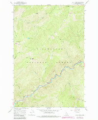
Editions of this 1966 Holly Creek Map
2 editions found
Other maps of this area

1911 · Lolo
USGS Topo · 1:250,000

1913 · Lolo
USGS Topo · 1:250,000

1956 · Hamilton
USGS Topo · 1:250,000

1959 · Hamilton
USGS Topo · 1:250,000

1960 · Hamilton
USGS Topo · 1:250,000

1964 · Hamilton
USGS Topo · 1:250,000

1965 · Lookout Peak
USGS Topo · 1:24,000
1965 · Cook Mountain
USGS Topo · 1:24,000

1965 · Horseshoe Lake
USGS Topo · 1:24,000
1966 · Greenside Butte
USGS Topo · 1:24,000