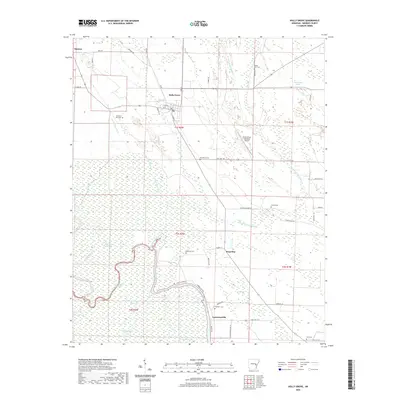
2020 Map of Holly Grove
USGS Topo · Published 2020About this map
Holly Grove serves as the primary hub in this Monroe County landscape, where the flat alluvial terrain is defined by a complex network of wetlands and drainage patterns. The settlement of Lawrenceville sits to the south near the banks of Maddox Bay, while smaller locales like Deep Elm and Duncan are connected by a grid of rural roads including State Hwy 146 and Maddox Bay Rd. The map reveals a high density of small burial grounds, such as Macedonia Cem, Redmans Cem, and Goodwin Cem, which serve as vital markers for local genealogical research.
Find a feature on this map
56 named features on this map. Tap any name to fly to it.
Don’t see what you’re looking for? This feature index may not catch every label — zoom into the map to look around manually.
Map Details
Editions of this 2020 Holly Grove Map
This is the sole edition of this map. No revisions or reprints were ever made.
Other maps of this area

1935 · Clarendon
USGS Topo · 1:62,500

1939 · Indian Bay
USGS Topo · 1:62,500

1940 · Holly Grove
USGS Topo · 1:62,500

1941 · De Witt
USGS Topo · 1:62,500

1941 · Clarendon
USGS Topo · 1:62,500

1948 · Helena
USGS Topo · 1:250,000

1950 · Helena
USGS Topo · 1:250,000

1954 · Indian Bay
USGS Topo · 1:62,500

1954 · De Witt
USGS Topo · 1:62,500

1955 · Helena
USGS Topo · 1:250,000