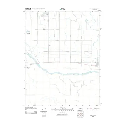
2010 Map of Holly West
USGS Topo · Published 2010About this map
The Arkansas River divides this agricultural landscape in eastern Prowers County, where a complex network of irrigation infrastructure defines the local economy. The terrain is marked by essential water management features like the Buffalo Canal, Holly Ditch, and Granada DITCH, which distribute water from the river to the surrounding plains. Small communities such as Hartman, Amity, and the outskirts of Holly are connected by a precise grid of county roads. For those tracing family histories or local settlements, the map identifies several significant locations including Hartman Cemetery, Amity Cemetery, and the small siding of Barton. The northern reaches of the sheet reveal larger water storage sites like Romer Reservoir, held by the Floyd Verhoeff Dam, illustrating the vital role of water engineering in supporting the high plains agricultural lifestyle of the early twenty-first century.
Find a feature on this map
45 named features on this map. Tap any name to fly to it.
Don’t see what you’re looking for? This feature index may not catch every label — zoom into the map to look around manually.
Map Details
Editions of this 2010 Holly West Map
This is the sole edition of this map. No revisions or reprints were ever made.
Other maps of this area

1890 · Granada
USGS Topo · 1:125,000

1891 · Albany
USGS Topo · 1:125,000

1892 · Granada
USGS Topo · 1:125,000

1893 · Albany
USGS Topo · 1:125,000

1894 · Granada
USGS Topo · 1:125,000

1953 · Holly West
USGS Topo · 1:24,000

1953 · Granada
USGS Topo · 1:24,000

1953 · Holly East
USGS Topo · 1:24,000

1954 · Lamar
USGS Topo · 1:250,000

1955 · Holly NE
USGS Topo · 1:24,000