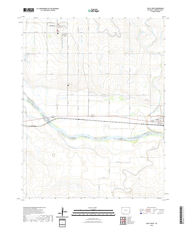
2022 Map of Holly West
USGS Topo · Published 2022About this map
The Arkansas River defines this High Plains landscape, accompanied by a complex network of irrigation infrastructure critical to local agriculture. Significant waterways such as the Buffalo Canal, Amity Canal, and Holly Ditch lace through the terrain, supporting the agricultural lifeblood of Prowers County. The small settlements of Hartman and Holly serve as the primary hubs, with the former featuring a classic grid of streets including W Railroad Ave and E Scott Ave. Local history is anchored by the Hartman Cem and Amity Cem, while the Air-Sprayers Number 2 Airport highlights the ongoing importance of aerial crop management in the region. Near the town of Holly, the Justin Harrington Memorial Walkway Trl follows the riverbank, providing a modern recreational layer to this traditional ranching and farming corridor.
Find a feature on this map
55 named features on this map. Tap any name to fly to it.
Don’t see what you’re looking for? This feature index may not catch every label — zoom into the map to look around manually.
Map Details
Editions of this 2022 Holly West Map
This is the sole edition of this map. No revisions or reprints were ever made.
Other maps of this area

1890 · Granada
USGS Topo · 1:125,000

1891 · Albany
USGS Topo · 1:125,000

1892 · Granada
USGS Topo · 1:125,000

1893 · Albany
USGS Topo · 1:125,000

1894 · Granada
USGS Topo · 1:125,000

1953 · Holly West
USGS Topo · 1:24,000

1953 · Granada
USGS Topo · 1:24,000

1953 · Holly East
USGS Topo · 1:24,000

1954 · Lamar
USGS Topo · 1:250,000

1955 · Holly NE
USGS Topo · 1:24,000