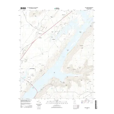
2014 Map of Hollywood
USGS Topo · Published 2014About this map
Guntersville Lake dominates the center of this landscape, its waters surrounding Bellefonte Island and the Bellefonte Bar. The settlement patterns here reveal a transition from the river valley floors to the higher elevations of Poorhouse Mtn and Backbone Ridge. Along the western shores, the city of Scottsboro and the town of Hollywood are connected by a dense network of routes including Us-72. Historically significant family markers and small burial grounds like Hansbrough Cem, Norwood Cem, and Chisenhall Cem are scattered throughout the hills, providing valuable data for genealogical research.
Find a feature on this map
121 named features on this map. Tap any name to fly to it.
Don’t see what you’re looking for? This feature index may not catch every label — zoom into the map to look around manually.
Map Details
Editions of this 2014 Hollywood Map
This is the sole edition of this map. No revisions or reprints were ever made.
Other maps of this area

1886 · Stevenson
USGS Topo · 1:125,000

1888 · Scottsboro
USGS Topo · 1:125,000

1892 · Scottsboro
USGS Topo · 1:125,000

1892 · Stevenson
USGS Topo · 1:125,000

1895 · Stevenson
USGS Topo · 1:125,000

1936 · Scottsboro
USGS Topo · 1:24,000

1936 · Wannville
USGS Topo · 1:24,000

1936 · Langston
USGS Topo · 1:24,000

1936 · Mud Creek
USGS Topo · 1:24,000

1936 · Dutton
USGS Topo · 1:24,000